Welcome
to UlsterApartments.Com
Harbours and Beaches
RNLI
Benone Strand and Magilligan Beach
Benone Strand and Magilligan Beach, has miles of golden sand and a magnificent back drop of mountain and cliff scenery with views across to Donegal.
European Blue Flag recipient.
The beach is used for a range of activities including surfing, kite sports and land yachting.
Travel the boardwalk from the beach and you will find Benone Visitor Centre, activities include nine hole par three golf course, golf practice range, crazy golf, tennis courts, outdoor heated splash pools and activities area with play park, Bistro and coffee shop.
Activity charges apply.
T 028 7775 0555
www.benoneni.com
www.visitcausewaycoastandglens.com
Castlerock Beach
Castlerock is a 1km (0.7 mile) long stretch of beach between the sea cliffs of Downhill to the west and the Lower River Bann estuary known as the Barmouth to the east.
Managed by Coleraine Borough Council, Castlerock beach backs on to the tranquil resort of Castlerock. The dunes to the east of the entrance are home to Castlerock Golf Club and a private caravan park. The dunes extend back upstream of the Bann estuary to Grangemore (some of the oldest dated dunes in Ireland) and a National Trust bird sanctuary. The beach and dunes is designated as a Special Area of Conservation (SAC) and an Area of Special Scientific Interest (ASSI).
Access: From Castlerock town. A recently completed environmental improvement scheme along the promenade and beach frontage has resulted in improved pedestrian access by means of 4 new boardwalks through the dunes, connecting the promenade and the beach. Cars are permitted on the eastern portion of the beach all year round, although access may be difficult due to accumulation of soft wind-blown sand (please heed signage at entrance). Walkers and anglers can walk along the concrete pier of the Barmouth but should exercise extreme caution at all times (inadvisable in high winds and breaking sea).
Note: watch out for the appearance of small harbour porpoises or seals feeding in the estuary at the Barmouth.
RNLI lifeguards on duty during July & August (11:00 - 19:00 daily).
Dog restrictions apply to the western portion of the beach from 1st May - 31st September.
Horse riding restrictions apply 1st May - 31st September (allowed before 11:00 and after 19:00 daily).
Portstewart Strand
Beach Safety
To ensure you and your family don't put yourselves in danger, the lifesaving charity, The Royal National Lifeboat Institution (RNLI) have offered some essential beach safety tips.
Top Tips to Stay Safe
Swim at a lifeguarded beach where possible, between the red and yellow flags
Never use inflatables in strong winds or rough seas
Check tide times before you go
If you get into trouble, stick your hand in the air and shout for help
If you see someone else in trouble, tell a lifeguard. If you can’t see a lifeguard, call 999 or 112 and ask for the Coastguard.
Those who can’t make it to a lifeguarded beach can take some basic steps to help keep themselves safe:
Find out about your chosen beach before you go at www.goodbeachguide.co.uk
Check weather and tides before you go
Read the safety signs at the beach entrance to make yourself aware of specific local hazards
If you get into trouble, stick your hand in the air and shout for help
If you see someone in trouble, call 999 or 112 and ask for the Coastguard but don't attempt a rescue yourself
Know Your Flags
Red and yellow flags indicate the area patrolled by lifeguards. These are the safe areas to swim, bodyboard and use inflatables.
Black and white chequered flags indicate an area zoned by lifeguards for use of watercraft such as surfboards and kayaks. Never swim or bodyboard in these areas.
The red flag indicates danger. NEVER enter the water when the red flag is flying, under any circumstances.
The orange windsock indicates offshore wind conditions. You should NEVER use an inflatable when the sock is flying.
For more information please visit www.rnli.org.uk.aragraph
West Strand
West Bay, also known as West Strand or Mill Strand, is a popular resort beach in the heart of the busy seaside town of Portrush. The beach is bounded at its northern end by the habour and flanked along its eastern boundary by a pedestrian/cycle promenade. There is easy access to and from the town centre and all associated amenities/services.
Keep an eye out for the resident pod of harbour porpoises just off the shore.
West Strand Beach regularly attains the international Blue Flag Award, most recently in 2019.
East Strand Beach
East Strand Beach forms a continuum of sand, approx 2.5 miles long, merging into Curran Strand and Whiterocks at its eastern extremity. East Strand Beach is popular for watersports all year round, especially surfing. The beach is bounded by an impressive new pedestrian promenade and an extensive dune system hosting the world famous Royal Portrush Golf Course. Excellent views of The Skerries and the Causeway headlands.
Please refer to all safety signage at East Strand Beach and heed advice given by lifeguards during the season.
Facilities: Car Parking, Dogs Allowed, Lifeguard Service, Toilets. The following facilities are available for users with limited mobility: disabled toilets and disabled parking. Concrete access ramps onto beach at both ends of promenade. Water quality is Good. Awards: Seaside Award Resort.
East Strand Beach and it's associated dune system has a rich biodiversity. Sea birds include fulmar, eider, gull, guillemot, gannet and tern. The dune system has been recently stabilised with help from The Conservation Volunteers.
Whiterocks Beach
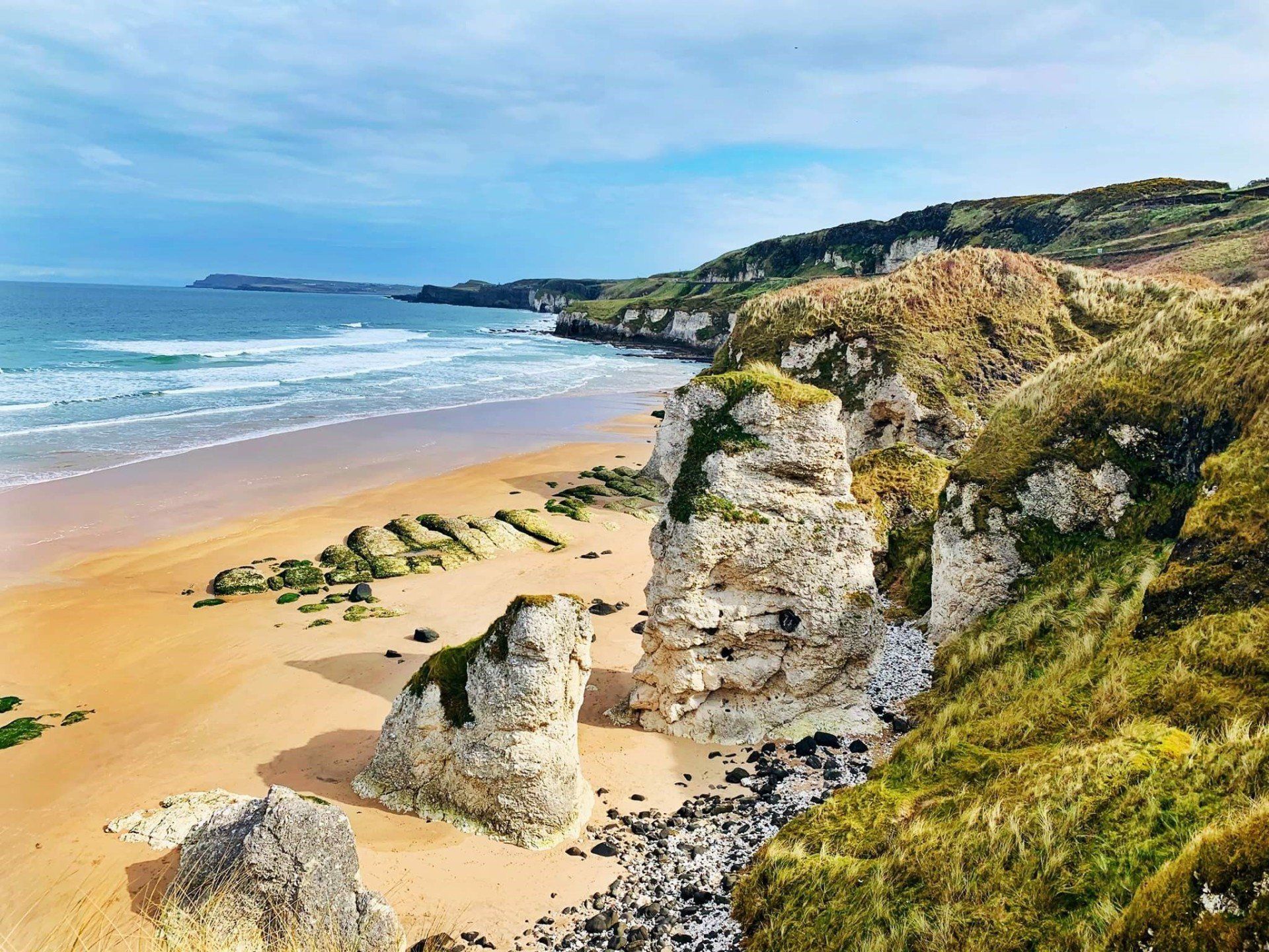
Awarded the prestigious Blue Flag Award again in 2015, Whiterocks Beach has become a favourite with locals and a must see destination for international visitors.
The beach, situated just off the Causeway Coastal Route, enjoys a stunning natural coastal location, with the limestone cliffs of the White Rocks stretching from Curran Strand to Dunluce Castle. These soft, sedimentary rocks have been carved through centuries into a labyrinth of caves and arches. Shelagh’s Head, the Wishing Arch, Elephant Rock and the Lion’s Paw are headlands of distinguishable forms which rise out of the ocean. Under the road, there are cavernous caves, accessible only from the sea, home to seabirds and a hunting ground for hawks.
On the main coast road, you will find pull-in areas and a large car park at Magheracross where you can take in the incredible views of the headlands eastwards towards the Giant’s Causeway and back to Portrush and
Portbalintrae & Runkerry Beach
Runkerry Beach, also known locally as Bushfoot Strand, is a geological Area of Special Scientific Interest. It is one of the most exciting beach systems in Ireland with a combination of very strong waves and currents, attractive scenery and natural history. The beach extends eastwards from the mouth of the River Bush towards Runkerry House and the famous Giant's Causeway.
The beach can be accessed via a footpath from the main car park in Portballintrae, before crossing the 'Threequarter' Footbridge.
Popular with surfers, this beach is also noted for its strong rip currents and shelving, and accordingly, bathing is inadvisable.
WhitePark Bay
This spectacular sandy beach forms a white arc between two headlands on the North Antrim Coast. Its secluded location means that even on a busy day there is plenty of room for quiet relaxation. White Park Bay has been in the care of the National Trust since 1938 and it remains one of the most natural coastline sites in N Ireland. The beach is backed by ancient dunes and species rich chalk grasslands, which are carpeted in rare plants, including many orchids. The site is also fossil rich with archaeological evidence everywhere.
Balintoy Harbour and Beach
The quaint dockland town of Ballintoy may have a small population – 165 people were recorded as residents in the latest census – but it continues to attract many curious tourists and TV location scouts around the world. From the amazing views of the Northern Coast to the long stretches of sandy dunes, here’s why you should add it to your holiday list this summer.
The harbour is a photographer’s dream
Ballintoy Harbour, meaning ‘Town of the North’, is built with limestone blocks in a roughly triangular shape at the edge of Ballintoy town. No matter the weather, the crowd of small boats and surrounding rocks make for a fantastic photo of the Northern Irish coast, which extends to Ballycastle on one side and Whitepark Bay on the other.
BallyCastle
Ballycastle Beach is a popular tourist destination located on the Causeway Coast Route on the Antrim Coast of Northern Ireland. Ballycastle Beach is approximately 1.2 kilometres in length and runs from the pier at Ballycastle Marina at the western end to Pans Rock in the east. Ballycastle Beach is comprised of predominately sand with some shingle. It backs on to Ballycastle Golf Course for most of its length. There is a promenade at the western end. The beach is located about 5 minutes from the town centre.
There are no restrictions on swimming at this beach and there are no lifeguards present on Ballycastle Beach at anytime.
Facilities: Car Parking, Child Friendly Areas, Dogs Allowed, Toilets, Tourist Information / Visitor Centre. Ballycastle Beach has the following facilities available for users with limited mobility: wheelchair access disabled toilets disabled parking Water quality is Good. Awards: Seaside Award Resort.


